I’m delighted to publish this guest blog from my friend and fellow cyclist Barry Ensten. He records a recent 87 mile cycle ride along the Ridgeway long distance footpath through beautiful scenery and covered over two days.
Ride the Ridgeway
Back in the summer I came across the ‘Run to the Stones’ ultra run (100k) which goes along the ancient Ridgeway and ends at Avebury in Wiltshire (where the stone circle is). I suggested it to Doug as something he could do, however this was only 3 weeks before the event so there was no way he could prepare in time.
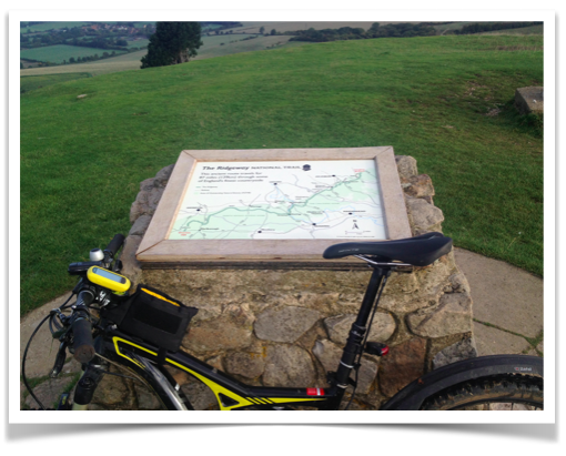
Anyway this got me thinking, why not ride it? After all Dunstable is only 7 miles from the start at Ivinghoe Beacon. The Ridgeway is one of the UK’s National Trails. It is an ancient route that goes from Ivinghoe Beacon, near Dunstable, Bedfordshire to Overton Hill in Wiltshire, which is under 2 miles from Avebury and is 87 miles. It is primarily a walking route, however a large portion of it is on Bridleways or Restricted Byways, so can be cycled. Most of the sections you can’t cycle are towards the Eastern end, near Ivinghoe Beacon. It is virtually all off road, so is really for mountain bikes.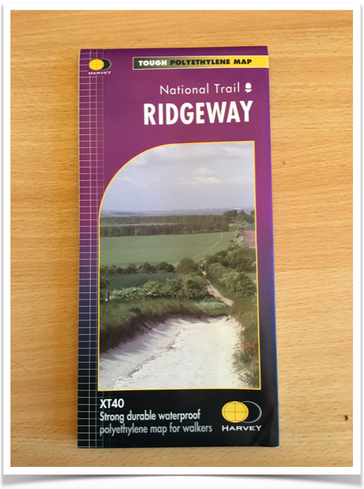
So with my interest piqued I purchased the map, which shows the walking route and shows which parts are footpaths, bridleways or byways and makes it easy to see where I needed to make a detour. There is also a GPX file (for Garmins) on the website which shows the walking route. I had this on my Garmin and used it as a guide to help me realise when I had missed a turn or was trying to find my way back to the path.
So assuming I was going to ride it, how do I get home afterwards? If I do it on a weekend when my wife is visiting her mother near Bristol, it wouldn’t be too much of a detour for to pick me up. Now 87 miles is too far to cycle off road in a day, particularly if it is muddy, so where to stay? Goring-on-Thames is pretty much at the halfway point, so I started looking. Well all of the hotels wanted silly money for a single room for one night, so I ended up booking the Youth Hostel in Streatley for the princely sum of £18, yes really. This would be a bit of an adventure, as at age 51 I had never stayed in a youth hostel (more on this later). They claim it is 150 yards from the Ridgeway path, so location is ideal. So with all the logistics sorted, all I needed to do was hope for decent weather, as if it was wet it would be grim.
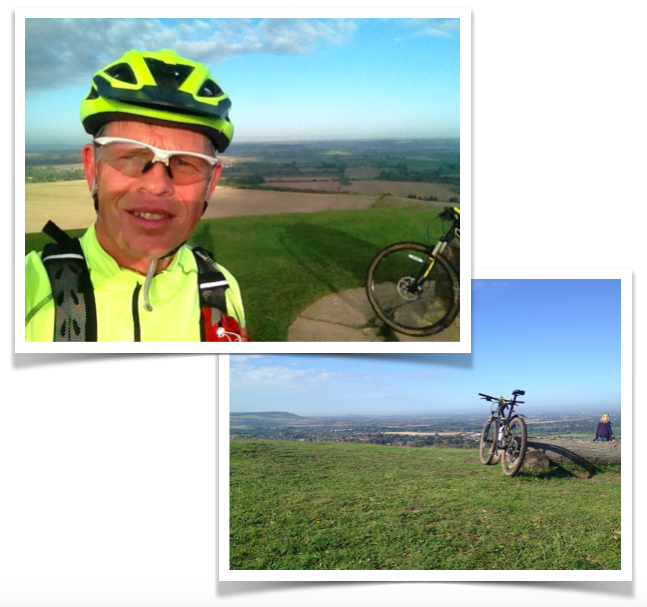
Next up was deciding what to take with me. Well the bike was the easy bit, the only choice was my Specialized Camber. The only thing I did was to fit winter (mud) tyres as a quick ride in the wet proved my existing tyres had lost too much tread over the summer to be any use in anything but bone dry conditions. As the Camber is a full suspension bike, panniers aren’t really an option, so rucksack it is. With a full drinks bladder, lock, spares and clothes the pack came in at a rather alarming 7kg. In the event this didn’t prove to be too much of an issue, provided I didn’t take any of the really rough stuff too fast. If I did the pack would start moving about a bit and as well as being uncomfortable, it did slightly unbalance me a couple of times.
The end of September this year enjoyed a bit of an Indian Summer, so the weekend promised to be totally dry and there hadn’t been rain for a few days, so it looked like the conditions would be ideal. To make things even better the forecast was a gentle easterly wind as well, so I would have a tail wind for all of the ride too! What could go wrong?
Day 1
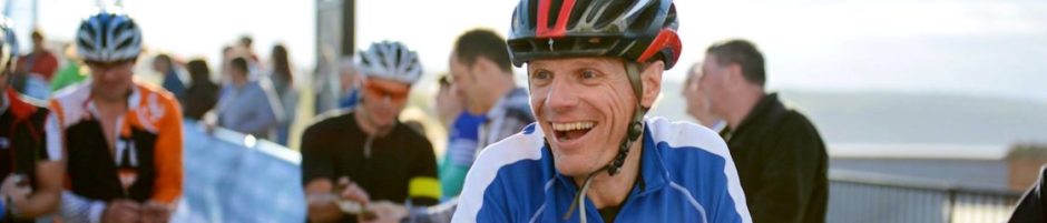
Saturday the 26th September dawned fine and sunny and I was standing on the top of Ivinghoe Beacon at 8:30 for the obligatory photo, and then we were off.
 Now the first part of the route is a footpath, so I pushed the bike down (honest) and rode on the road to the first off-road section that you are allowed to ride, at Pitstone hill. It brings you out near Tring station and then there is a few miles back on the road to the top of the Wigginton climb. From there it is off-road untill you hit the road again at the top of The Crong. The next section is a footpath, so an on-road diversion is required to the top of Hastoe Hill, where there is a cracking off-road decent through the woods into Wendover. When you are riding off-road you realise just how close together these road climbs are.
 From Wendover it’s off-road again to climb Coombe hill. There is a Boer war memorial on the top of Coombe Hill, but I didn’t stop as the route goes through the woods and it was incredibly boggy, this was definitely the worst conditions on the whole ride. Despite it being a chalk hill there must be a layer of clay on top, as at times my wheels were sinking into the squishy goo.
With a quick wave to David Cameron as I passed Chequers. The Ridgeway takes a footpath that skirts the edge of Chequers, so I followed the road, as I didn’t want to attract the attention of any heavily armed coppers!
Next up is Whiteleaf, but it is done off-road! Now I have to admit to getting a bit lost in the woods at the base of Whiteleaf, and spent some time skirting the edge of the golf club, before finding a route to the top, and what a route it was. Bare chalk and with added tree routes to-boot. I did try to cycle up the 20% incline but with a backpack there was no way I could keep the front wheel on the ground, so I had to push. However, when you get to the top what a view!
So after a quick blast down Kop Hill (wee!) onto a Bridleway that meets up with The Swan Way that you follow all the way to Goring. This marks the first change in the terrain. Up to this point it is very much up and down, but now runs along the base of the Chiltern Hills so is much flatter, but gets any “run off” from the hill, so it was a bit boggy. There is even a special tunnel under the M40 for the Ridgeway near Watlington. Watlington is the last civilisation you will see before Goring, so I found a pub and sat in the sun watching the Red Kites circling away whilst tucking into Burger and Chips!
As you get nearer to Goring there is another detour you have to take, as the Ridgeway becomes a footpath again and separates from the Swan Way for a short way, before coming back together on Grims Ditch.
Grims Ditch is aptly named, as it is less than 1 foot wide and weaves through trees, true single track. To make matters worse the path has sunk over the years, so get it slightly wrong and you are eating the vegetation. Now this is fine for a couple of hundred of metres, but this went on for nearly 2 miles, by which time my brain hurt with the concentration.
By now I was only about 7 miles away from Goring and had a wonderful view of Didcot Power station, something that would stay with me for the next 20 miles.
The run in to Goring followed the Thames, but I went wrong somewhere and ended back on the road for the last 3 miles. I arrived in Goring having clocked up 43 miles in about 6 hours including stops.
Goring is a very pretty little town and I made for the river where I treated myself to an Ice cream and watched the boats go by for a while. Just to prove just how posh Goring is a family of four, plus the Au Pair, set up camp next to me for some family “Quality Time”.
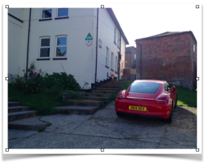 When I got to the Youth Hostel the poshness was reinforced further when I found a new Porsche in the car park. Just in case you didn’t believe me I took a photo to prove it.
Well it so happens the owner of the Porsche was called Peter and was in the bunk above me! He’s a Pharmacist from Altringham and was down training for the Autumn 100 ultra marathon which is a 100 mile trail running event based in Goring. It uses both the Ridgeway and the Thames Path. He is hoping to complete it in around 13 hours. Over the weekend he was doing 2 runs totalling 63 miles, how his joints are still ok I don’t know.
Day 2
The next morning, after a hearty breakfast I set off on the second leg. The Ridgeway does not pass any towns between Goring and Avebury, so it is best to take everything you need with you, so my pack was even heavier, as lunch was squashed in too. Goring has a decent bike shop on the high street, so there is an opportunity to stock up on any supplies you need. The terrain changes again, with a long climb of about 3 miles, then there is mile after mile running along the top of the downs. This is a major horse racing area, being near to Newbury and Lambourne, so I was riding alongside lots of gallops. Didn’t see any horses though. It felt like I wasn’t making any progress as I could see the path heading off to the horizon and every time I looked to the right there was Didcot Power stations yet again. It turns out the Ridgeway describes a gentle arc for about 20 miles which means Didcot Power station always seems to be in the same place. The first real change came near the White Horse at Pewsey, where the path deteriorates and becomes very rutted bare chalk. In particular there was a section where I had to ride a traverse of bare chalk, which would be un rideable in the wet.
By now I was approaching Swindon the Ridgeway has to deviate from the ancient route to negotiate the M4. If you drive along the M4 towards Swindon it passes through a dip in the ridge just prior to J15.
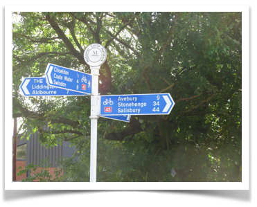 Having crossed the M4 you are faced with a stiff climb up to the ridge before skirting along the top of a bowl that is about 5 miles across. The temptation to cut across this bowl was too much and I followed a road shown on my Garmin that appeared to be heading part way to the other side of the bowl. Well luck was on my side because after about 2 miles I came across NCN route 45 and a sign that said ‘Avebury 9’.
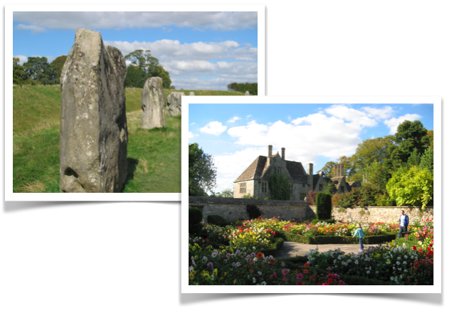
So off we set and it lead me onto a track that gently climbed up the side of the ridge and bought me back onto the Ridgeway proper. It was then only about 4 miles to Avebury, but the path became very muddy and rutted, before dropping down into Avebury. I kept looking for the stone circle, but it is surrounded by trees and only spotted them when I was right on top of them.
Avebury is a lovely place and a great, place to relax whilst waiting to be picked up. It is run by the National Trust, so there the requisite cafe and shop, plus a museum and of course the stone circle to look at. Rather surprisingly the main road goes straight through the middle of the stone circle, something that would definitely not be allowed these days.
Looking Back
So having completed the ride, what are my thoughts? Well first of all it would be really hard to do it in a day; 87 miles may not sound too far for a road ride, but off-road is a different matter. It is not just the physical side, but the concentration required to pick a good line all the time. At the end of each day I was probably more mentally tired than physically tired. The other thing to consider is the weather, this is a ride that is best done in the summer, as in winter there will be lots of that sloppy chalky mud that is really slippery and areas of wet bare chalk that becomes an ice rink. The backpack worked surprisingly well and didn’t move about too much, which was good, however if I were to do a lot of this I would get some of the Alpkit bike packing bags to take some of the weight off of me. I had debated whether to take a lock or not, as it weighs so much, but was glad I did as it was used. The downside of taking the lock was it weighs 1.5kg, so it would be much better if I could either get it on the bike, or find something lighter.
Would I do the ride again, possibly, but I would be more tempted to choose a different long distance ride.

 RSS – Posts